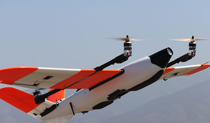
Censys Technologies, along with an Aviation Regulator’s NAS Modernization Group (AJW-124), conducted a series of Beyond Visual Line of Sight (BVLOS) drone operations over a two-day period totaling 82 miles. Four flights were conducted with varying distances and payloads through Censys Technologies’ Sentaero BVLOS platform. These operations simulated an emergency reconnaissance of a remote radar asset.
After natural disasters, roads are often inaccessible, making data acquisition from the air one of the only means of intelligence collection. AJW-124 is evaluating BVLOS operations and identifying capable uncrewed aerial vehicles (UAVs), such as the Sentaero BVLOS, as a reliable tool for damage assessment.
“When disaster strikes, knowing what tools you have and how to leverage them most effectively can be a game-changer when evaluating critical assets,” said Seth Hasty, AJW-124 UAS Operations Program Lead. “Tools like Censys Technologies Sentaero BVLOS are great because they can be rapidly deployed, carry lower risks compared to manned aircraft and deliver detailed asset inspection.”
To date, most post-storm assessments have been conducted with crewed aircraft, but an exercise like this allows AJW-124 to put together a stronger natural disaster deployment strategy by utilizing UAVs.
“No matter the weather event, the Sentaero platform supports a range of sensors that provide critical information, which we recently demonstrated to AJW-124,” said Censys Technologies Director of Engineering and Flight Operations Mark Twibell. “Given the flexibility of the Sentaero, use of a Sentourion Mobile Command Center will allow first responders to comfortably conduct site assessments, identify damage, and develop appropriate planning.”
Censys Technologies looks forward to working with the AJW-124 team on future projects that support them in achieving their mission.


