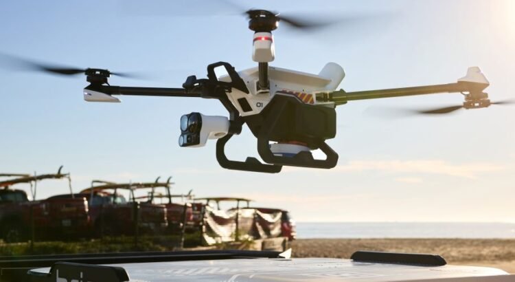
BRINC today announced a $125 million financing round led by Motorola Solutions, with participation from Index Ventures and Dylan Field, Figma’s CEO and founder. The investment brings BRINC’s total capital raised to over a quarter billion dollars and will fuel the company’s mission to deploy 911 response drones at the 80,000 police and fire stations […]
Unmanned Systems
Unmanned Systems


Oregon Department of Aviation Releases New Drone Training and Testing Template for Oregon Public Agencies
The Oregon Department of Aviation (ODAV) has released a new training and testing companion to its public agency drone policy template, giving Oregon public bodies a clearer path for training, evaluating, and documenting the people who fly drones for public work. The earlier ODAV template helped agencies answer an important question: What rules should guide […]

GeoCue Welcomes Steel City Drones as New Distributor for TrueView and LP360 Solutions
GeoCue has announced Steel City Drones as a new distributor of GeoCue TrueView LiDAR systems and LP360 software. Founded in 2011, Steel City Drones has spent the last 15 years serving customers across the drone industry, including public safety, construction, surveying, energy and utilities, agriculture and inspection markets. The company supports customers throughout the continental […]
Vantis Capabilities Unlocked for Traffic Management and BVLOS Flights
The Northern Plains UAS Test Site is unlocking the unique capabilities of Vantis to operators for no cost, offering the ability to fly Unmanned Aircraft Systems (UAS) Beyond Visual Line of Sight (BVLOS), beginning July 1, 2026. With this, operators will get Application Programming Interface (API) access and onboarded on the statewide UAS system at […]
Oregon to Host Aviation Delegation from South Korea to Advance International Collaboration and Innovation
The State of Oregon will host a high-level South Korean aviation delegation July 26–30, 2026, to explore investment, research, and commercial partnership opportunities across the aviation, uncrewed aircraft systems (UAS), and advanced air mobility (AAM) sectors. The delegation, approximately 25 government, industry, and research representatives from the Ministry of Land, Infrastructure, and Transport (MOLIT), the […]
Oregon Department of Aviation Releases UAS Operations and Policy Manual Template for State and Local Agencies
The Oregon Department of Aviation (ODAV) has released a new Unmanned Aircraft Systems Operations and Policy Manual template to help Oregon state agencies, cities, counties, special districts, and other public bodies develop safe and consistent drone programs. The template is designed as a practical starting point for agencies that use, or are considering the use […]
Ohio’s NAAMCE Expands the Test Environment Advanced Air Mobility Innovators Need to Validate and Scale
As the Federal Aviation Administration continues advancing the regulatory framework for beyond-visual-line-of-sight (BVLOS) operations, the National Advanced Air Mobility Center of Excellence (NAAMCE) is expanding the real-world test environment companies need to move from promising technology to operational reality. Located in Springfield, Ohio, NAAMCE is the only facility in the United States offering an end-to-end […]
Vantis Expands BVLOS Capabilities as Frontier Precision Joins as New Champion Operator
Vantis, North Dakota’s beyond‑visual‑line‑of‑sight (BVLOS) system, has reached another major milestone with the onboarding of Frontier Precision as its second champion operator. Frontier Precision has secured a new FAA waiver for BVLOS operations, expanding their operational capabilities available through the Vantis service volumes. The waiver is fully aircraft‑agnostic for systems under 55 pounds, allowing Frontier […]
FlyGuys Returns as Partner for Second Annual Elevate Scholarship Program, Connecting Certified Drone Pilots to Nationwide Career Network
FlyGuys has announced its continued support of the Elevate Scholarship Program for the second consecutive year, joining the National Center for Autonomous Technologies in offering 300 scholarships covering the $175 FAA Part 107 remote pilot certification test fee. The program targets students ages 16-24 enrolled in aviation or uncrewed systems programs across the United States. […]
Embry-Riddle, FDOT Host Inaugural Summit to Shape Future of Advanced Air Mobility in State
More than 300 leading researchers, policymakers and aviation innovators gathered at Embry-Riddle Aeronautical University for the first-ever Florida Advanced Air Mobility (AAM) Symposium, featuring two days of talks and advanced demonstrations on this revolutionary class of aircraft poised to transform how people and cargo are moved through the skies and the emerging sector’s potential economic […]
