Photo above – Sakari Röyskö | Forum Virium Helsinki A series of surveys reveals that citizens in six European cities strongly favor drone usage for emergency services and environmental monitoring. In Helsinki, citizens worry about criminal activity and invasion of privacy. In six cities, Helsinki, Hamburg, Stockholm, Gdansk, Riga, and Tartu, more than 8 000 […]
Unmanned Systems
Unmanned Systems


NDOT Aeronautics Division Strengthens Drone Security Through Approved Drone List
The Nebraska Department of Transportation (NDOT) Aeronautics Division has published a list of approved drones in compliance with the Secure Drone Purchasing Act (LB660). Under this law, NDOT Aeronautics Division must create and maintain the list in order to meet state and federal cybersecurity standards. The list is published and maintained at dot.nebraska.gov/aeronautics/drones. Starting Jan. […]
Nevada UAS Test Site and Eagle Field Airport Form Strategic Collaboration to Accelerate UAS and AAM Testing Across Western U.S.
Eagle Field Airport LLC and the Nevada Center for Applied Research (NCAR) at the University of Nevada, Reno have formed a strategic partnership to advance research, development and flight testing of Unmanned Aircraft Systems (UAS) and Advanced Air Mobility (AAM) technologies. The partnership brings together Eagle Field’s historic private airfield in California (Federal Aviation Administration […]
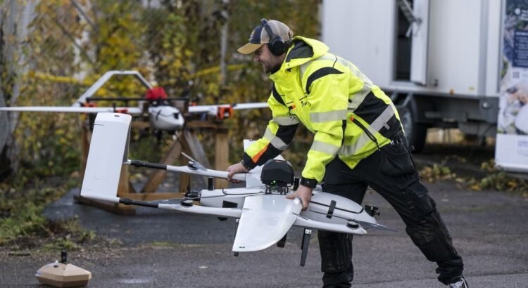
New Board of Directors Appointed at Everdrone Ahead of Accelerated Expansion
Everdrone AB has announced the appointment of a new Board of Directors, following a decision at an Extraordinary General Meeting held on Wednesday, 21 January 2026. The newly elected board brings broad strategic experience to support the company’s next phase of national and international expansion. “The new board members will support Everdrone’s next steps to […]
Indiana’s National Drone Site Puts Arrive at the Center of Autonomous Delivery Scale
Arrive AI highlighted last week the strategic importance of Indiana’s selection as a newly designated federal Unmanned Aircraft System (UAS) testing site. It’s the first such designation in more than a decade. Announced by U.S. Department of Transportation Secretary Sean P. Duffy and FAA Administrator Bryan Bedford, the designation places Indiana at the center of […]
Vantis Enables ISight Drone Services to Expand BVLOS Operations
Vantis, North Dakota’s beyond-visual-line-of-sight (BVLOS) system, has achieved another significant milestone with the approval of its first drone operator authorized to fly BVLOS across all four Vantis operational volumes, or service areas. ISight Drone Services has received a Part 107 BVLOS waiver, expanding its approved operations into eastern North Dakota and enabling statewide service volumes […]
Everdrone Appoints Senior Medical Advisor to Support Continued Expansion
Everdrone is strengthening its medical perspective by appointing specialist physician David Borkmann as Senior Medical Advisor. The appointment is a step in the company’s continued expansion in Sweden and Europe, where the need for medical expertise is growing in parallel with the development of new collaborations within emergency healthcare. The focus is on how drones […]
ZenaTech Completes 20th Acquisition in Year One of Drone as a Service, Strengthening California Wildfire Management and Public Works Opportunities
ZenaTech, Inc. announced it has completed its 20th acquisition. The most recent acquisition is L.D. King, Inc., a well-established civil engineering and land surveying firm based in the Los Angeles area, further strengthening its footprint for drone solutions in one of the most wildfire-sensitive and natural disaster-prone regions in the US. This acquisition caps a […]
USDOT Secretary Duffy & FAA Administrator Bedford Announce Two New Designated Sites for Testing Drones and Other Unmanned Aircraft Systems
U.S. Department of Transportation Secretary Sean P. Duffy and Federal Aviation Administrator Bryan Bedford announced two new test sites for Unmanned Aircraft Systems (UAS). The sites, which will be located in The Choctaw Nation of Oklahoma and Indiana Economic Development Corporation, are the first new UAS testing grounds in nearly a decade. The UAS Test […]

Nokia Drone Networks Integrates Amprius SiCore® Batteries to Advance High-Reliability Operations
Amprius Technologies, Inc. announced that Nokia has selected Amprius’ SiCore® cells to power its next-generation drone systems. Following extensive qualification and testing, Amprius’ batteries demonstrated the endurance, power delivery, and safety performance needed to position this drone-in-a-box solution among the most capable UAV platforms on the market. Amprius’ balanced cells deliver burst power required for […]
