Intellisense Systems, Inc. has introduced Quantimet, a software platform that provides present weather reporting, cloud-based data-logging, trend visualization, and remote control of autonomous environmental sensors. It is available as a beta release to owners of Intellisense’s Weather Sensors. The platform is designed to be sensor agnostic and will also support data reported from other environmental sensors including AWARE Flood Sensors and third-party meteorological sensors through the Quantimet API.
Quantimet represents the next evolution in environmental reporting software by collecting data from a broad range of Internet of Things (IoT) devices and leveraging the advantages of cloud-based data-logging. Intellisense offers remote sensors connected to the Internet via an assortment of communications technologies including cellular, satellite, RF radio, and hardwired. There is no need to store data locally in remote devices that are always connected to the cloud. Cloud-based data logging takes advantage of the cost savings, infinite capacity, instant availability, and backup protection inherent in cloud storage solutions.
“Intellisense has been developing software solutions for our government customers for many years,” said David Miller, Vice President and General Manager of Products and Engineering at Intellisense Systems. “Quantimet is our first commercial tool intended to benefit all users from national defense to commercial markets. Over the next few months, we’ll refine the software with the user feedback and launch it as a paid Software as a Service (SaaS) portal in the Fall.”
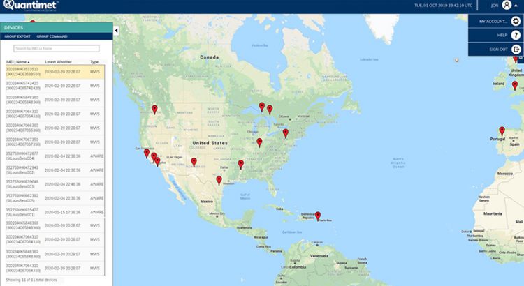
Users can access the software at Quantimet.com. Once logged in, they will be able to see all their associated environmental sensors on a world map based upon the GPS location of each unit, which can individually be selected for the most recent or historical data. The data is available in a parameter view, as time graphs, and in METAR format. When camera units are available on the autonomous sensors, the transmitted images are available for viewing. Control commands may also be sent to remote sensors to change the operating mode or reporting frequency.


