Safe distancing is rapidly becoming the new normal for people, which not only affects their personal lives, but also their daily professional routines. Working in a hands-on or close-quarters environment presents many challenges that increases risk for potentially spreading a deadly virus, such as COVID-19. Companies are scrambling to search for innovative ways to help staff continue to perform their jobs, including identifying different means of communication and figuring out how to leverage technology to complete projects.
Geospatial technology is built on the premise of collecting highly accurate and detailed information from a distance, without ever physically touching the object of interest. Who knew that the geospatial industry has been focused on safe distance data collection for decades? Can this technology help your staff work safely in the comfort of your company’s controlled environment?
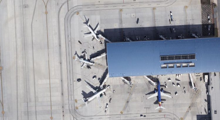
Data acquisition platforms are quickly evolving to help increase rapid access to LiDAR and imagery data. These range from large rotary and fixed-wing aerial platforms to simple handheld scanners on cell phones. These diversified collection methods provide numerous alternatives for architects and engineers to work on airport projects from the comfort of their own homes.
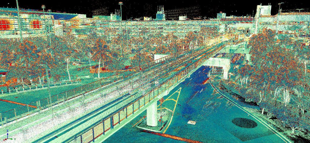
A single project, such as an airport expansion project, uses static, aerial, and mobile LiDAR sensors to generate a spatially accurate dense 3D point cloud. These are key tools for detection and mapping of obstructions; pavement condition analysis for runway and taxiway resurfacing; concrete rehabilitation projects; and collecting architectural and structural elements of terminals to aid in the development of a detailed Building Information Model (BIM). GPI uses these complex sensors to connect the airside and landside spatial data while maintaining compliance with FAA Advisory Circulars.
The aviation industry continues to adopt the use of digital 3D models and integrate the technology with existing Geographic Information Systems (GIS) and asset management programs. These models can be used through the lifecycle of a facility, beginning with concept plans, navigation through construction, and finally incorporated into airport operations. Spatially accurate 3D models decrease the need for site visits by designers, significantly reducing their exposure to viruses and decreases interruptions from less operational staff who are accessing secure areas.
Business continuity plans are integrating new communication protocols to include virtual meetings and video conferencing. These plans are including ways to leverage technology to integrate data and design across multiple teams. Large-scale projects are successfully delivered using cloud collaboration, leveraging BIM technology on complex design assignments, enabling dozens of design experts to virtually work together on a facility as if they were physically present. BIM technology paired with virtual reality and augmented reality creates an incredibly realistic digital representation of airport facilities, for both current and future planned designs. This enables the simulation of physical appearance, performance, and projected costs to aid in design decisions and approval processes.
A strategic 3D modeling or BIM execution plan should be considered in the development of a business continuity plan. This plan should establish clear project goals, procedures, communication structure, data sharing collaboration standards, and assign team member responsibilities. Trust your geospatial provider to collect the data required to work remotely from the job site. This is an excellent opportunity to modernize the way you do business.


