Airbus Aerial has been selected to provide its domain expertise in unmanned aircraft systems as part of a team of private-sector firms supporting the Unmanned Aircraft Systems (UAS) Integration Pilot Program (IPP). The IPP is a three-year U.S. Department of Transportation (DOT) program implemented through the Federal Aviation Administration (FAA), aimed at developing a regulatory […]
Unmanned Systems
Unmanned Systems


NCDOT Joins FEMA Drone Working Group
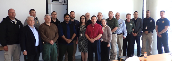
Drones are an increasingly integral part of all emergency response operations, so the North Carolina Department of Transportation (NCDOT) is working to make sure the state’s drone operators are prepared when disaster strikes. NCDOT’s Division of Aviation Office UAS (Unmanned Aircraft Systems, or ‘drones’) Program Office, in partnership with N.C. Emergency Management, is working with […]
AirMap Selected as UAS Service Supplier in Six UAS IPP Awards
Today, the U.S. Department of Transportation and the Federal Aviation Administration announced the state, local, and tribal governments approved to enable complex drone operations in 10 locations, and AirMap is included in six of them. The announcement comes as part of the U.S. DoT’s UAS Integration Pilot Program (IPP), designed to accelerate the integration of […]
PrecisionHawk Joins its Home State of North Carolina as 1 of 10 Chosen for Unmanned Aircraft Systems Integration Pilot Program
PrecisionHawk Inc., a leading provider of enterprise drone technology, today announced that it was selected to participate with its home state of North Carolina in 1 of 10 pilot programs focused on drone integration, introduced by the Trump administration last year. The project was chosen by the Department of Transportation (DOT) from 150 applications submitted […]
U.S. Selects 10 Drone Programs for Testing
Accompanied by technology innovators and government leaders from across the nation, U.S. Secretary of Transportation Elaine L. Chao today announced the 10 state, local and tribal governments who will conduct flight tests as part of the Unmanned Aircraft Systems (UAS) Integration Pilot Program. “We know our diverse new partners will help us address a broad […]

North Carolina DOT Selected for FAA Drone Integration Pilot Program
U.S. Transportation Secretary Elaine L. Chao today announced that the N.C. Department of Transportation has been selected as one of only 10 participants in the Federal Aviation Administration’s Unmanned Aircraft Systems (UAS, or ‘drones’) Integration Pilot Program, an initiative that will shape the future of drones in America. “We are looking forward to helping today’s […]

Texas County Establishing Aviation Unit for Use of Drones in Law Enforcement Work
The Liberty County, Texas Sheriff’s Office has joined the growing trend across the United States among both small and large law enforcement agencies in establishing an aviation unit and utilizing the new and growing technology of small Unmanned Aerial Vehicles ( UAV) for a multitude of assignments. The Unmanned Aerial System ( UAS ) that […]

Insitu and University of North Dakota Partner in Unmanned Aircraft Systems Curriculum
Insitu Inc., a wholly-owned subsidiary of The Boeing Company, and the University of North Dakota at Grand Forks (UND) announced significant additions to the university’s Unmanned Aircraft Systems (UAS) degree program and research enterprise. In conjunction with UND’s 50th Anniversary of Aviation Education and Research, the university will integrate Insitu’s INEXA™ Control, TacitView™ and Catalina™ […]
Airbus Aerial and DroneBase Team Up for the World’s First Multi-Source Data Services Solution
Airbus Aerial and DroneBase have announced a partnership that delivers the world’s first multi-source data service solution for aerial imagery and data from a single provider. This effort enables companies that have previously used a variety of separate sources for their data and imagery insights to now use a single, global service provider. “We are […]
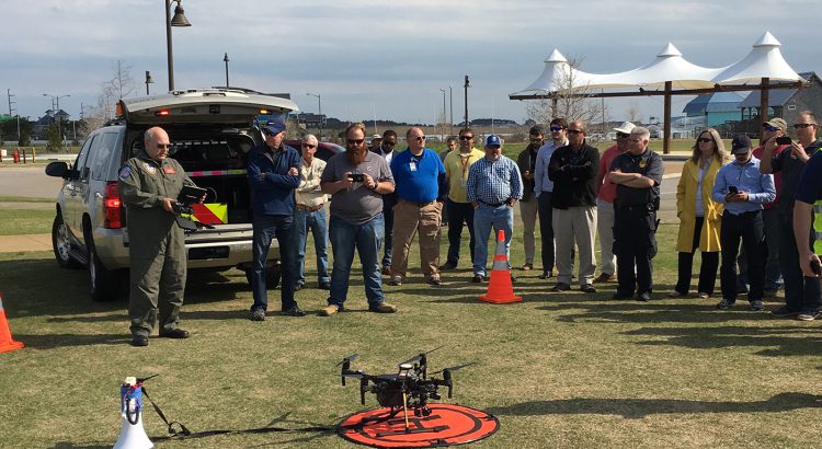
NCDOT Hosts Outer Banks Drone Workshop
With drones able to do more than ever before, the N.C. Department of Transportation wants to help educate local government agencies and businesses on some of those potential practical applications. A capacity crowd was on hand Thursday as NCDOT’s Division of Aviation Unmanned Aerial Systems (UAS) Program Office hosted a free workshop for government and […]
